Saturday, March 2, 2019

2 Mar 2019 - Three Rivers Petroglyphs and McGinns PistachioLand

2 Mar 2019
Temps are mild but the winds here are nuts-o!  On the east side of the Organ Mountains they are expecting high winds all day, but 30-40 mph gusts this evening.  The winds followed us today as we headed back east on Highway 70.  We were routed into the Border Patrol Checkpoint.  They have a whole array of cameras and sensors checking us out as we approached the inspection point. 


The Border Patrol agent was very nice, asked us a couple questions and sent us on our way.  We continued east on highway 70 and then north on highway 54 to the Three Rivers Petroglyph site.


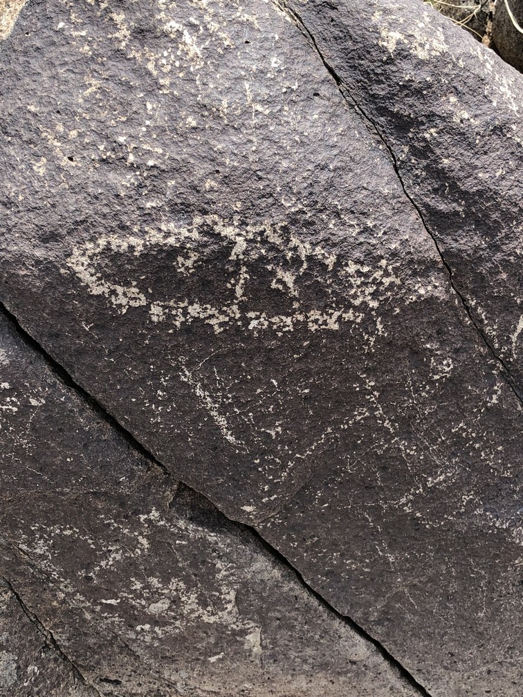
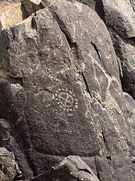
Petroglyphs are rock artwork created by 'pecking' through the dark petina surface on the volcanic rocks with stone tools to create designs. The lighter color stone shows through with some amazing artwork. The petroglyphs at Three Rivers dates back to 900-1400 AD and were created by the Jornada Mogollon people. This site contains over 21,000 petroglyphs "including masks, sunbursts, wildlife, handprints, and geometric designs".  The nice part of this site is the petroglyphs are easy to access and are within a 0.5 mile trail.

We made our way to the visitor center and met a couple from Wisconsin at the desk.  She was the park ranger and he was taking care of the entrance fee and helping us with maps.  I presented my National Park Pass and the entrance fee was waived.  We forgot our trekking poles in the RV but they had some nice walking sticks for us to use.
We entered the trail head and made our way up the trail to the first petroglyphs.  From there, we were literally tripping over them.  


The park ranger told us to use our imagination as to what the artwork symbolized.  Some appears to be animals, possibly fish, deer or turtles.  The further up the trail we climbed, the better view of the white sands we had.  The wind was creating havoc there.  We could see the sand dust clouds obscuring view of the mountains in the background.
We continued up the trail and discovered more and more petroglyphs.  What were they doing when they created these?  What is the significance of them?  


We reached the top of the loop and then headed back down the other side.  We could have gone further, but with Doreen's recent back surgery and the back issues I've had recently, neither of us thought it prudent to push our luck.  
In the distance were some interesting and scenic rock formations. 


Snow on the mountains behind
We captured a few more pictures before exiting the trail loop.


Dry river bed
 As we departed the park, we passed the old Three River's School, dated 1904.  It looks as if it has been preserved very well, and may even still be in use.

We continued our drive south to Alamogordo and the winds and dust storms on the white sands continued to be very visible in the distance. 

Our next stop was the McGinn PistachioLand Tree Land and Store.  They also have a winery there. 

World's largest pistachio!
We went inside and did a wine tasting while waiting for the next tour. 
Doreen selected one of their wines and we got a couple bottles to go.  While we waited for the tour to start, we walked around the store and discovered their pistachio bar.  You can sample all of the flavors of pistachio nuts and they have some pecans as well as various flavors of pistachio brittle too!

The pistachio bar with cups for your samples.

Bags of the various flavors available for purchase.
Soon we headed out on the tour with our tour guide James.   We had a family from the Phillipines on our tour bus also.


 PistachioLand encompasses a 111 acre farm with over 12,300 pistachio trees and 7600 grape vines.  They produce approximately 7000 gallons of wine each year.  This amount would have been tripled, but in February 2011 they lost 85% of their vines with temp's at -15 degrees F.   James took us around the vineyard and the pistachio grove.  He explained what is involved ion growing both, and there is obviously a lot to it.  Most of the pistachios in the United States are grown in New Mexico, Arizona and California.  Most of the world's pistachios are grown in the Middle East.
Vineyards


Pistachio groves


The larger of the trees, pictured here,  is the male and it does not produce nuts, it produces pollen to fertilize the female trees.  
The male trees produce pollen pods the size of pine cones.  The female trees do not flower, so bees do not pollinate the trees.  Wind carries the pollen to the female trees that have a sticky bud on them.  The nuts produced ripen in July and each nut consists of a hull, a shell, and nutmeat.  Pistachio trees require one gallon of water per day to thrive.  At the end of the growing season, the water supply is increased, the nuts swell and they crack! 

After the tour, we headed back into the store and sampled a pistachio cookie and some pistachio ice cream.  Both were delicious!
As we drove back to the RV Park, the wind continued to stir up the white sand.  We decided to postpone our visit to the White Sand National Monument until tomorrow.

Back at the RV Park, Doreen got us all caught up on laundry and we 'battened down the hatches' for the relentless winds that continue as I write this 10:49 pm.  


Friday, March 1, 2019

1 Mar 2019 - Arrived at White Sands Missile Range NM

 1 Mar 2019
Today we pulled chocks at Roswell at 0815 hrs and headed west and south to White Sands Missile Range (Army) NM.  It was a beautiful drive.  The headwind and elevation climb took it's toll on the fuel mileage but the scenery made up for it!  The climb started at Roswell 3573 ft, peaked at Apache Summit 7519 ft and then down hill to White Sands Missile Range 4346 ft.  Here are a few scenery pictures from the drive.

The drive started very flat with a few hills in the distance.  The ground was pretty barren and very dry.


The further west we drove, the bigger the hills became.  The road was very smooth and there was literally no traffic which made for a great drive.


 Snow capped mountains in the distance were visible, and we drove through elevations that had snow in the shadows along side the road.


 We passed Apache Summit and it was pretty much all down hill from there.  Off in the distance white sands came into view.


 The closer we got, the more brilliant the white sand became.  It extends for was appears to be hundreds of miles.
We passed a few small towns and scattered buildings and houses, some appeared to be adobe construction.

 From Tularosa and Alamogordo, around past Holloman Air Force Base we skirted the edge of the White Sands area.  We plan to come back to this to see it in more detail.


 Mile after mile of pure white gypsum sand.  Approximately 275 square miles of area.  It is quite a beautiful site.


Just before reaching the Organ Mountains we turned south and after just a few miles entered the White Sands Missile Range Headquarters.  The Missile Range itself encompasses over 600,000 acres, the largest military installation in the United States,  and is used for military testing.  The history dates back to 1930's and was the site for Trinity where the first nuclear bomb was detonated.  The headquarters for this operation is here, an Army facility that also has a nice RV park where we will stay for the next four nights. 

We quickly found the RV park and per their instructions found a vacant site and set up the RV.  Then I had to go to the golf course clubhouse to pay, which is closed and now the home of the MWR office who manages the RV park.  $10 per night for full hookup - that's insane!  The KOA in Albuqueque on our return trip, and the KOA in Apache Junction/Mesa are both over $60 per night!

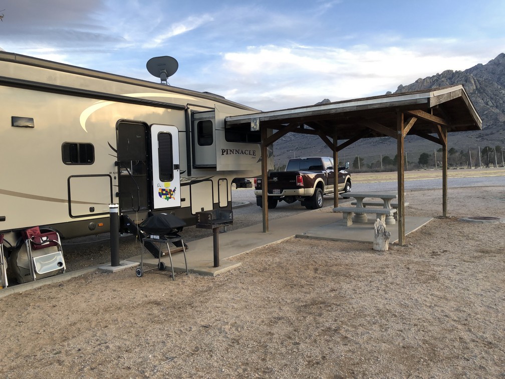
There were only two vacant sites and they were identical.  The sites are very narrow and we had to 'thread the needle' to park the RV such that the slideouts would clear nearby structures and the utilities would reach. 
Our US and Air Force Colors flying high and proud.  

There are only eight RV sites here, so we feel fortunate to have secured a reservation.

The sites are pretty plain.  Gravel sites with gravel areas in between

About four or five inches between the passenger side living room slideout and the shelter.

Only a couple inches on the driver's side between the kitchen slideout and the power box and water fixture.

Each site has it's own little shelter area with a concrete picnic table and benches. 
We can only imagine hot brutally hot it is here in the summer months.

Out of the desert comes beauty.


Beautiful scenery right outside our door.

The Organ Mountains with a setting sun behind.


We have a lot on the list to squeeze in for the next few days.  We want to get back to a pistachio farm we passed on the way here, plus visit the White Sands National Monument.  Time permitting we would like to return to Alamogordo and visit the Space Museum.  We also will visit the Missile Museum right here on post and we hope to get to Las Cruces to see some sights there too.  Tuesday morning we head to Tucson AZ.